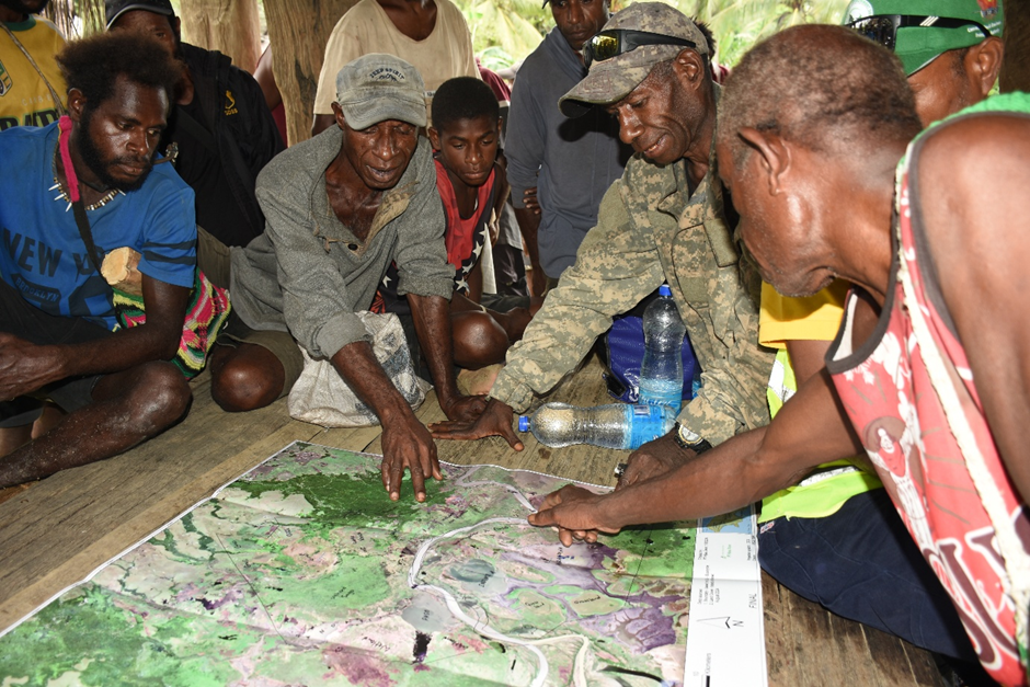
As part of our commitment to inclusive development and responsible land governance, Borderlands Green Ltd facilitated a participatory mapping session with the Timbunke community in East Sepik Province.
During the session, members of the Timbunke community gathered to review and verify the extent of their clan lands using printed satellite maps. This hands-on approach allowed landowners to physically mark the boundaries of their clan territories—ensuring accuracy, transparency, and cultural alignment with their existing land knowledge.
The activity not only confirmed the mapped boundaries of the Incorporated Land Groups (ILGs) in the area but also validated that these boundaries are consistent with the clans’ traditional land demarcations. Such alignment is critical for upholding customary land rights while advancing sustainable development planning.
By placing community members at the center of decision-making, Borderlands fosters land ownership, trust, and long-term stewardship. Participatory mapping sessions like this are vital for preserving cultural heritage, avoiding land disputes, and ensuring that any future land-use activities are grounded in consent and shared understanding.
Leave a Reply